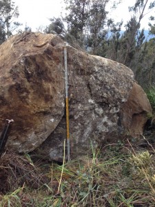
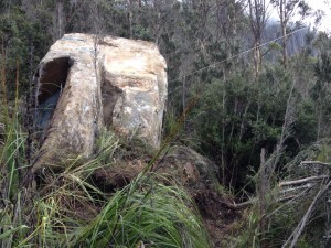
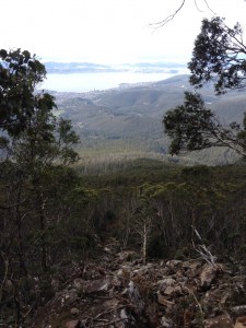
On 8 July, Hobart City Council asked me to assess the risk posed to road users and track walkers from a large dolerite boulder (50t) which had toppled off a small cliff section on steep (40+degree) slopes on Mt Wellington. Despite the millions of already-toppled boulders on the adjacent talus slopes, geological time is immense and rockfalls are rare enough to be noteworthy. This boulder was also larger than most, and since it did not break up, its travel path was longer than most. It came to rest in a muddy bouldery watercourse 170m downslope, about 20m across the Pinnacle Track.
I arrived at the site a few hours after the fall. With daylight hours fading, and uncertain about the boulder’s stability, I though we ought to close the Pinnacle Road to the summit of the mountain. Council organised this immediately.
Next morning, after a Council crew cleared scrub from around our rock, it was clear that the boulder had come to rest against other smaller ones. I thought the potential for it to remobilise was “unlikely’, and the risk to life to a road user 300m downslope was “tolerable”. Pinnacle Road was reopened, and we instigated a set of monitoring points around the boulder to further assess its stability.
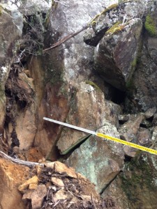
A scramble uphill by me and Matt Lindus (Council’s Acting Manager of Bushland & Reserves) found the source – an empty 2.5m wide space between two smaller but similarly leaning boulders. We temporarily closed Pinnacle Track while I reviewed slope stability issues, runout distances and hillside slopes. Overnight, I satisfied myself that the risk to track users was also “tolerable”, and recommended that the track be reopened. We’ll be looking to see what measures (if any) are needed to reduce the likelihood of the two remaining boulders toppling. Monitoring shows that the fallen boulder seems to have stabilised.
My risk assessments included reference to the Australian Geomechanics Society series of volumes on Landslide Risk Management (2007), and to the good work being done by Colin Mazengarb and Michael Stevenson at our local Mineral Resources Tasmania. They’ve produced a series of Landslide Hazard Maps for major population centres in Tasmania. (The Potential Rockfall Hazard Map for Hobart not surprisingly identifies the steep slopes of Mt Wellington as at risk of rockfalls, but it also shows that Pinnacle Track, and most others, are at risk of runout of boulders across them.) I also had valuable discussions with Victorian geotechnical engineer Tony Miner, my erudite sounding board for more than a handful of landslide issues.
I suspect that if a detailed assessment was done of walking tracks on the mountain, the risks to walkers would range from “acceptable” through “tolerable” to “unacceptable”. But closing high risk tracks would no doubt be a very unpopular move. Maybe we should redefine what we mean by acceptable and unacceptable risk for activities which are inherently riskier than others, but in which we willingly and knowingly engage.


Leave a Reply