• Services
    • Geotechnical Investigations
    • Landslides
    • Soil Testing
    • Groundwater
    • Wastewater
    • Coasts
    • Contaminated Sites
  • Products
    • Cromer Hydrogeological Calculators
    • Cromer Constant Head Field Permeameter
    • Trench® Wastewater Software
  • About
  • News
    • News Archive
  • Publications
    • Cromer Reports Database
  • Contact me

Bill Cromer

Home » News » Monitoring groundwater in vulnerable coasts in southeastern Tasmania

Monitoring groundwater in vulnerable coasts in southeastern Tasmania

June 17, 2015 by Bill Cromer Leave a Comment

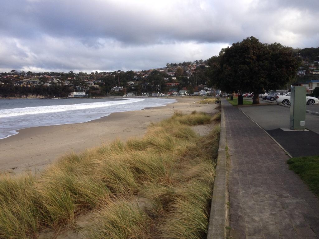
I have recently been engaged by Kingborough Council in southeastern Tasmania to set up groundwater monitoring sites in Kingston Beach (pictured), and Adventure Bay on Bruny Island. Both are low-lying beachside precincts, and their real estate and buried infrastructure (sewer pipes, gas and power networks, etc) are most at risk from rising water tables caused by rising sea levels. Browns River (catchment area 60km2) discharges to the River Derwent at Kingston Beach, and Captain Cook Creek (catchment area 17km2) flows to the sea at Adventure Bay. From a surface flood perspective, the worst-case scenario at any time is high intensity rainfall + high tide + storm surge – a situation which will increase in frequency and impact as sea and groundwater levels rise.

Digital water level recorders are being installed in shallow, screened boreholes at both towns. Water table fluctuations caused by tides, rainfall, groundwater extraction and rising sea level will be captured. The data, downloaded quarterly or twice-yearly, will be used to calibrate a numeric groundwater model for Kingston Beach (at least) and will contribute to storm modelling being compiled by Council.

The monitoring bores are intentionally located at proposed Tasmarc transects.


Kingston Beach, Tasmania
Kingston Beach, looking south, May 2015


Filed Under: Vulnerable Coasts and Sea Levels

Leave a Reply Cancel reply

Your email address will not be published. Required fields are marked *

Subscribe to my newsletter
Profile of Bill Cromer

Geologist, thylacine author, tennis player [more about me].

Contact Bill

  • Email
  • Google+
  • Twitter

PH 0408 122 127

INT +61 408 122 127

Recent Posts

  • Codes in the 2015 Tasmanian Interim Planning Scheme
  • Flowchart for applying the Tasmanian Acid Sulphate Soils Code
  • Flowchart for applying the Tasmanian Coastal Erosion Hazard Code
  • Tasmanian Landslide Code
  • Tasmanian On-site Wastewater Management Code

News Archive

View full archive

News Archive by Month

  • August 2016 (3)
  • May 2016 (2)
  • August 2015 (1)
  • June 2015 (2)
  • March 2015 (7)
  • February 2015 (1)
  • July 2014 (2)
  • June 2014 (1)
  • March 2014 (1)
  • December 2013 (2)
  • November 2013 (1)
  • October 2013 (6)
  • July 2013 (3)
  • May 2013 (2)

Professional Services

  • Geotechnical Investigations
  • Soil Testing
  • Groundwater
  • Wastewater
  • Coasts

Products

  • Cromer Hydrogeological Calculators
  • Cromer Constant Head Field Permeameter
  • Trench® Wastewater Software

News Categories

  • Apps & Software
  • Cromer Permeameter
  • General
  • Geology
  • Geotechnical Investigations
  • Groundwater
  • Landslides
  • Thylacine
  • Vulnerable Coasts and Sea Levels
  • Wastewater
  • Home
  • Professional Services
  • Products
  • About
  • News
  • Publications
  • Contact me

Contact

  • Email
  • Google+
  • Twitter

PH 0408 122 127

INT +61 408 122 127

Copyright ©2025 Bill Cromer. All Rights Reserved.