• Services
    • Geotechnical Investigations
    • Landslides
    • Soil Testing
    • Groundwater
    • Wastewater
    • Coasts
    • Contaminated Sites
  • Products
    • Cromer Hydrogeological Calculators
    • Cromer Constant Head Field Permeameter
    • Trench® Wastewater Software
  • About
  • News
    • News Archive
  • Publications
    • Cromer Reports Database
  • Contact me

Bill Cromer

Home » News » Reinterpreting the coastal geology south of Charles Darwin Cliff at Sandy Bay, southern Tasmania

Reinterpreting the coastal geology south of Charles Darwin Cliff at Sandy Bay, southern Tasmania

March 16, 2015 by Bill Cromer 1 Comment

Downloads

  • Logs of three geotechnical diamond drill holes [PDF 169 KB]

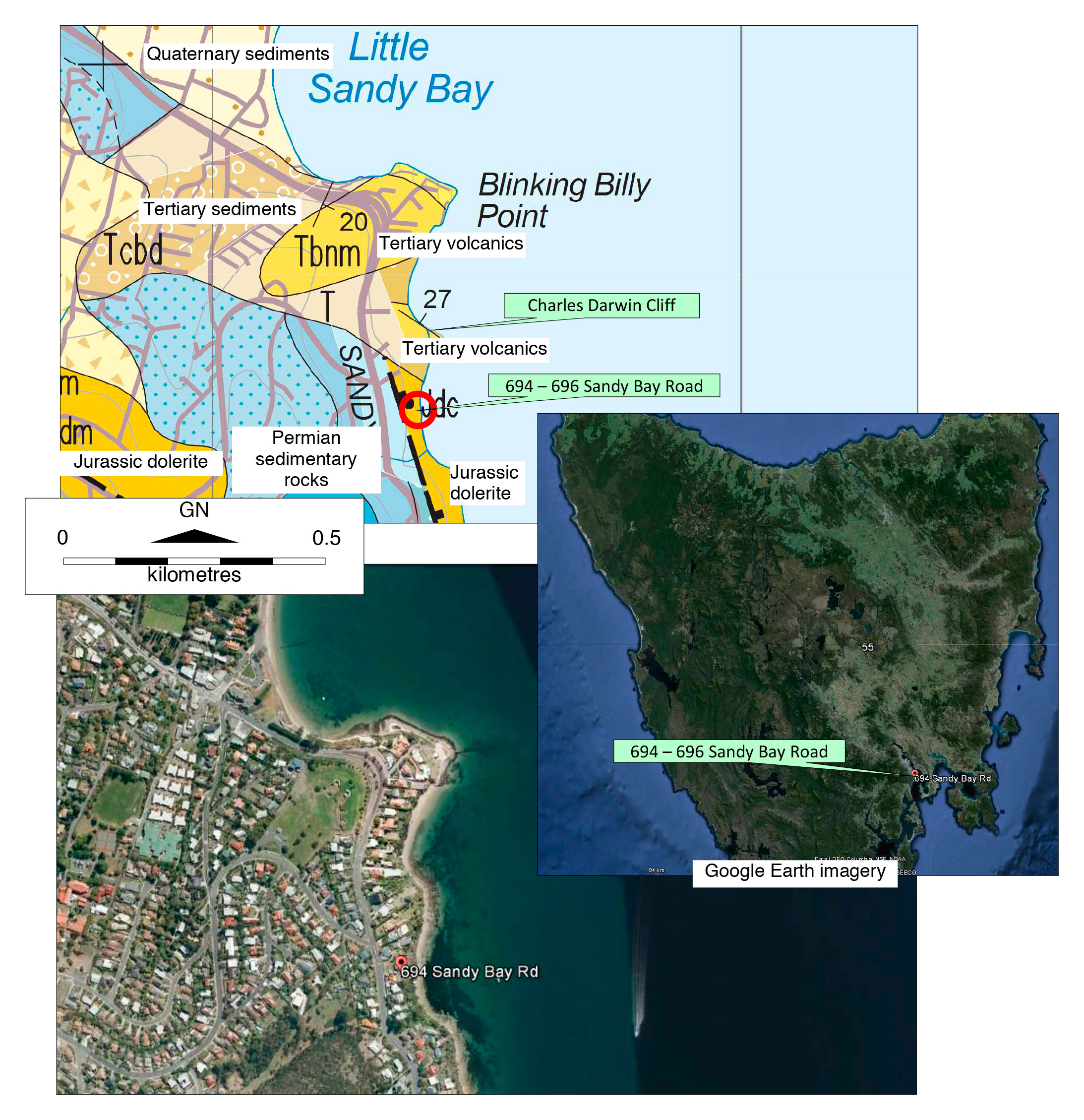
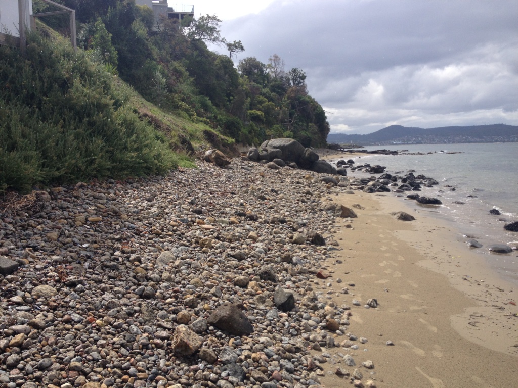
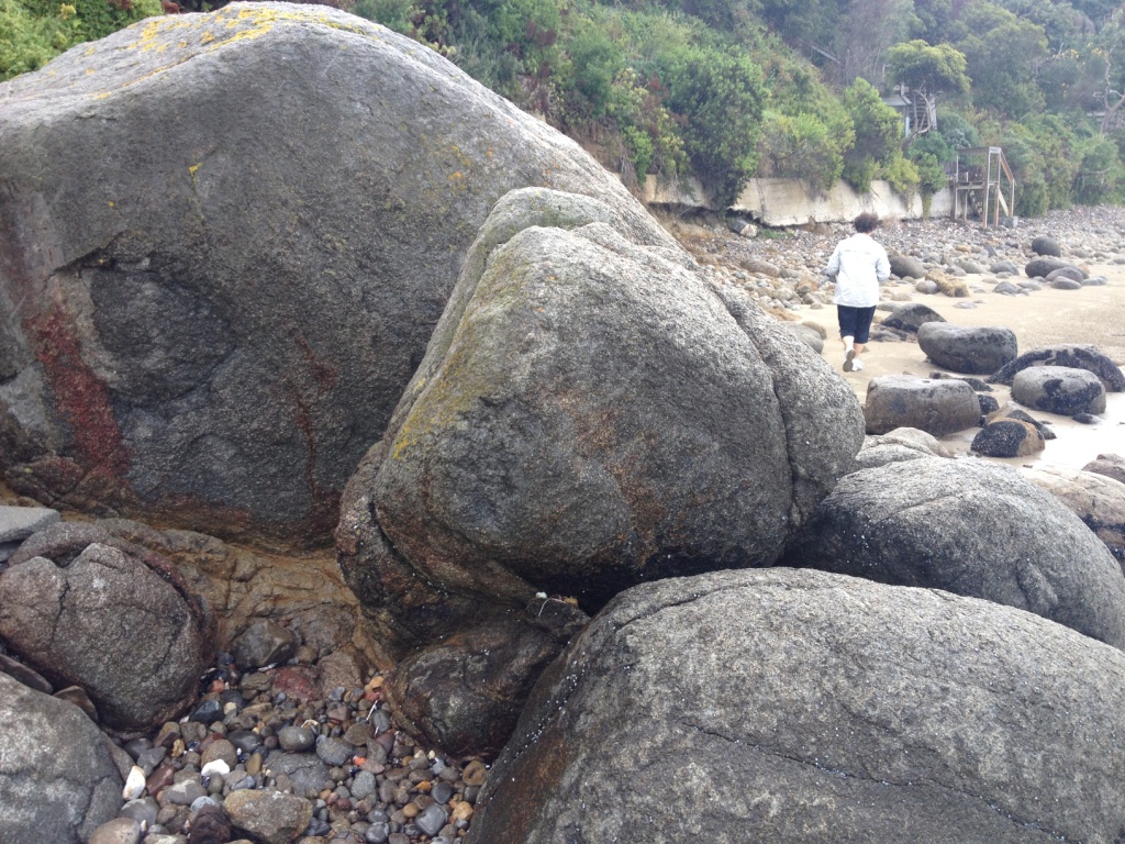
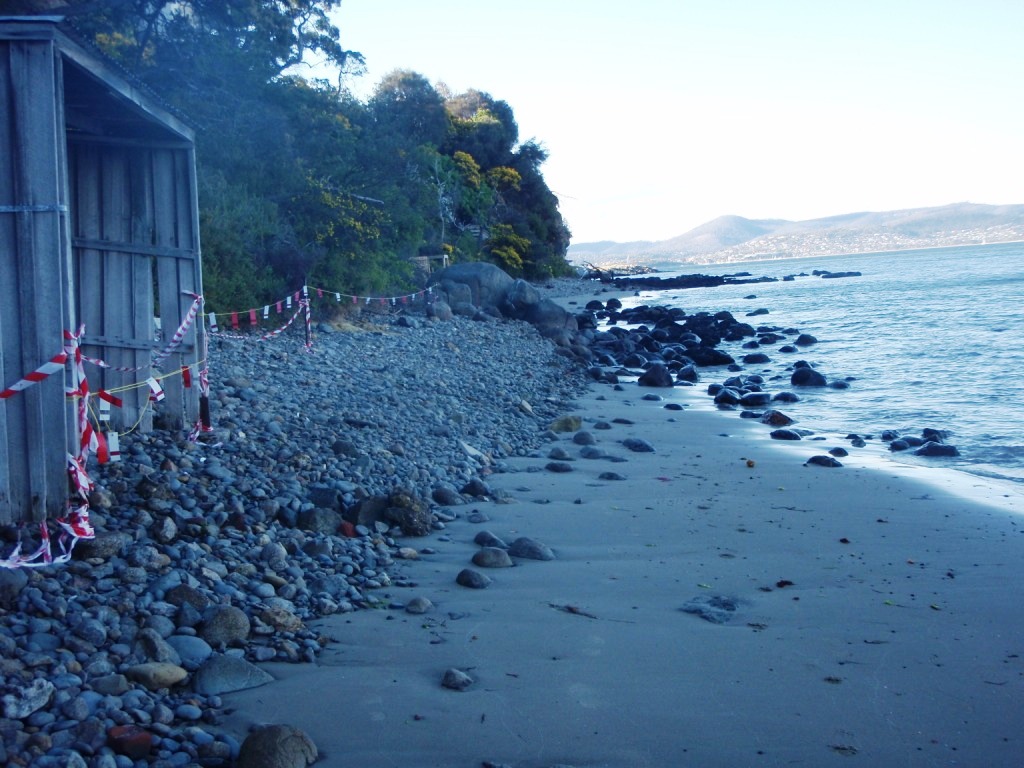
Extremely weathered dolerite cobbles and boulders embedded in a dense to very dense matrix of extremely weathered and hydrothermally altered doleritic material are well exposed on the foreshore, and less well exposed on the steep coastal embankment, for several hundred metres south of the Tertiary volcanics at Charles Darwin Cliff at Sandy Bay.

The published 1:25,000 scale digital geological map of Hobart interprets the material as Jurassic-age dolerite bedrock – faulted against Parmeener Supergroup sedimentary rocks to the west. The location is close to where the NW – SE Cascades Fault Zone abuts the NNE – SSW Taroona Fault.

Geotechnical investigations in 2008 for proposed townhouses at 694 – 696 Sandy Bay Road show the published geology needs to be amended. The investigations included geological mapping, clearing an excavator access track across the 20m high coastal embankment, digging several excavator test pits, and drilling three diamond drill holes – two of them to sea level. View the drill hole logs. The interpreted geology (all materials are inferred to be Tertiary or younger) became somewhat clearer after extensive site excavations for the townhouses.

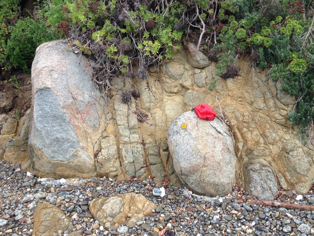
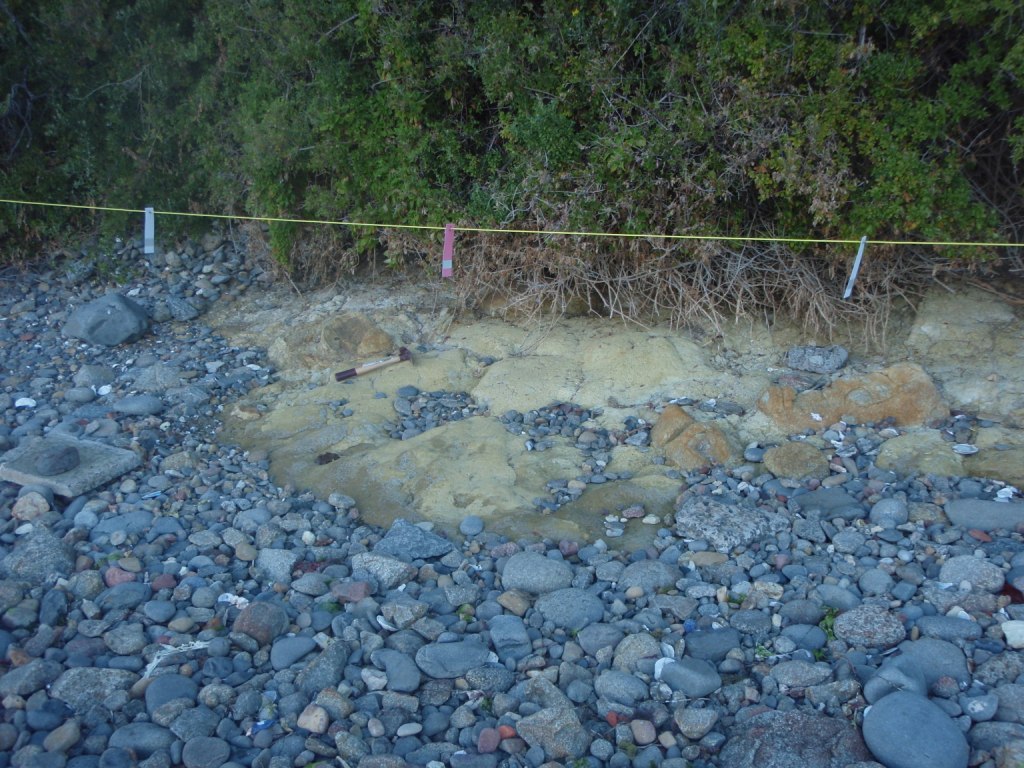
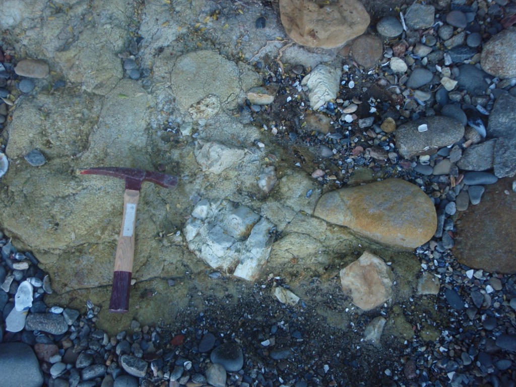
The first important observation was the presence of volcanogenic? sandstone with Permian-age clasts exposed after storm activity on the foreshore below 694 – 696 Sandy Bay Road. The sandstone apparently underlies doleritic material previously interpreted by others as dolerite bedrock. On the embankment above the volcanogenic? sandstone is a small outcrop of spheroidally- and extremely-weathered doleritic material in a doleritic silt/sand/gravel matrix, here re-interpreted as Tertiary-age boulder beds. The adjacent test pits and access track revealed sedimentary breccias and tuffaceous materials, and one of the diamond drill holes passed through two occurrences of volcanic ash separated by breccia. The third drill hole closer to Sandy Bay Road cored Permian-age bedrock from 6m, beneath 3m of volcanic ash underlying 3m of Tertiary?/Quaternary? breccia.

The geology in this small area is complicated. It is also unclear how far south along the coastal embankment and foreshore these Tertiary rocks extend, and whether sections are indeed in-situ dolerite bedrock. It is interesting to speculate whether the volcanic ash is the same material as (a) that interbedded with volcanic agglomerate at nearby Charles Darwin Cliff, and (b) the ash and agglomerate exposed on the foreshore and at the Taroona High School a few kilometres south. (I’ve also recently posted a blog reporting inferred volcanic ash between two Tertiary boulder beds in Glenorchy, 10km to the NNW.)

Geological map and aerial photograph of Charles Darwin Cliffs and surrounds Sandy Bay, Tasmania

View south from Blinking Billy Point in Sandy Bay towards the volcanic rocks on Charles Darwin Cliff at the end of the beach.

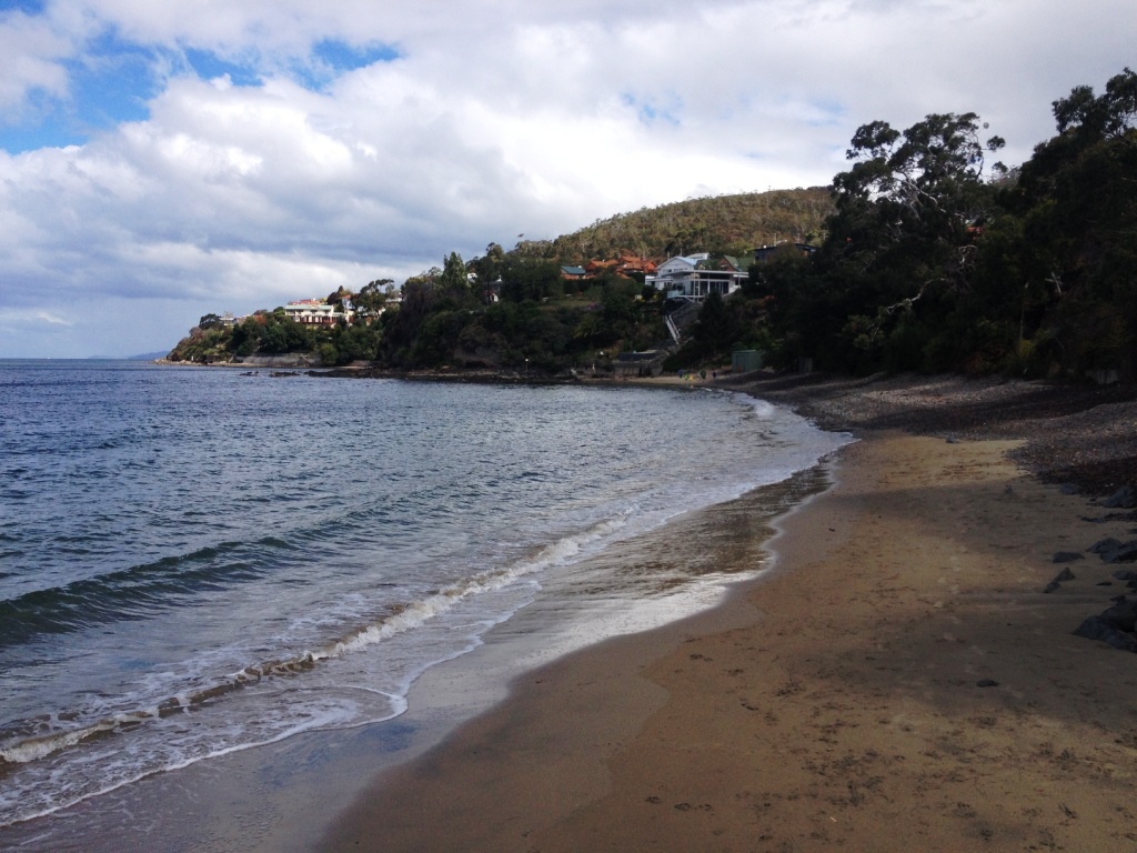
(Charles Darwin spent 12 days in Hobart in 1836. He did indeed walk this beach, and inspect the geology of the foreshore.)

View north towards the volcanic rocks on Charles Darwin Cliff.  The foreshore is littered with dolerite and sandstone cobbles. In the middle ground are large dolerite boulders.
View north towards the volcanic rocks on Charles Darwin Cliff. The foreshore is littered with dolerite and sandstone cobbles. The large boulders in the middle ground are of dolerite. At left is the coastal embankment leading up to 694 – 696 Sandy Bay Road, where detailed geotechnical investigations were conducted in 2008 for residential development.
Exposures of dolerite on the foreshore below Sandy Bay Road showing spheroidal weathering
It is understandable that exposures of dolerite like this on the foreshore below 694 Sandy Bay Road have been mapped by others as in-situ Jurassic dolerite bedrock. The spheroidal (“onion-skin”) weathering, the commonality of joint alignment and similarity of grain sizes across the 3m wide exposure all suggest undisturbed bedrock.
A detail of large spheroidally-weathered dolerite boulders in the intertidal zone, adjacent to the exposure interpreted as dolerite bedrock showing the doleritic matrix between the boulders.
A detail of large spheroidally-weathered dolerite boulders in the intertidal zone, adjacent to the exposure interpreted as dolerite bedrock (previous photo). Note the doleritic matrix between the boulders. Dolerite boulders larger than these occur further south on the foreshore, and also at the Hobart suburb of Taroona, where they are being winnowed out of Tertiary sediments.
Detail of a brecciated zone in doleritic material on the foreshore near Charles Darwin Cliff. Hydrothermal alteration like this is very common in the area.
A detail of a brecciated zone in doleritic material, on the foreshore south of 694 – 696 Sandy Bay Road. Hydrothermal alteration like this is very common in the area.
A view north towards Charles Darwin Cliff past large dolerite boulders in the middle ground. To the left of the boulders is an orange/brown/yellow outcrop exposed by storm waves.
A view north towards Charles Darwin Cliff in 2008, past the large dolerite boulders in the middle ground. To the left of the boulders, on the foreshore below 694 – 696 Sandy Bay Road, is an orange/brown/yellow outcrop exposed by storm waves. The outcrop is interpreted as volcanogenic sandstone with Permian sandstone clasts, of inferred Tertiary age.
A detail of volcanogenic sandstone with Permian sandstone clasts on the foreshore below  Sandy Bay Road, Tasmania.
A detail of volcanogenic sandstone with Permian sandstone clasts on the foreshore below 694 – 696 Sandy Bay Road. It appears to underlie the dolerite boulders, and is inferred to be Tertiary in age.
Detail of Permian sandstone clasts in volcanogenic sandstone on the foreshore south of Charles Darwin Cliffs, Sandy Bay, Tasmania
Detail of Permian sandstone clasts in volcanogenic sandstone below 694 – 696 Sandy Bay Road.
Extremely spheroidally weathered dolerite boulders, and an indurated Permian? sandstone/siltstone clast, all embedded in the same orange doleritic-textured matrix
Extremely spheroidally weathered dolerite boulders, and an indurated Permian? sandstone/siltstone clast, all embedded in the same orange doleritic-textured matrix, on the foreshore below 694 – 696 Sandy Bay Road.

Filed Under: Geology

Comments

  1. Tas Walker says

    January 31, 2017 at 1:37 pm

    Hi Bill, this is a very interesting article. I’m taking some folk to visit this site in February and your material is really helpful.

    Reply

Leave a Reply Cancel reply

Your email address will not be published. Required fields are marked *

Subscribe to my newsletter
Profile of Bill Cromer

Geologist, thylacine author, tennis player [more about me].

Contact Bill

  • Email
  • Google+
  • Twitter

PH 0408 122 127

INT +61 408 122 127

Recent Posts

  • Codes in the 2015 Tasmanian Interim Planning Scheme
  • Flowchart for applying the Tasmanian Acid Sulphate Soils Code
  • Flowchart for applying the Tasmanian Coastal Erosion Hazard Code
  • Tasmanian Landslide Code
  • Tasmanian On-site Wastewater Management Code

News Archive

View full archive

News Archive by Month

  • August 2016 (3)
  • May 2016 (2)
  • August 2015 (1)
  • June 2015 (2)
  • March 2015 (7)
  • February 2015 (1)
  • July 2014 (2)
  • June 2014 (1)
  • March 2014 (1)
  • December 2013 (2)
  • November 2013 (1)
  • October 2013 (6)
  • July 2013 (3)
  • May 2013 (2)

Professional Services

  • Geotechnical Investigations
  • Soil Testing
  • Groundwater
  • Wastewater
  • Coasts

Products

  • Cromer Hydrogeological Calculators
  • Cromer Constant Head Field Permeameter
  • Trench® Wastewater Software

News Categories

  • Apps & Software
  • Cromer Permeameter
  • General
  • Geology
  • Geotechnical Investigations
  • Groundwater
  • Landslides
  • Thylacine
  • Vulnerable Coasts and Sea Levels
  • Wastewater
  • Home
  • Professional Services
  • Products
  • About
  • News
  • Publications
  • Contact me

Contact

  • Email
  • Google+
  • Twitter

PH 0408 122 127

INT +61 408 122 127

Copyright ©2025 Bill Cromer. All Rights Reserved.