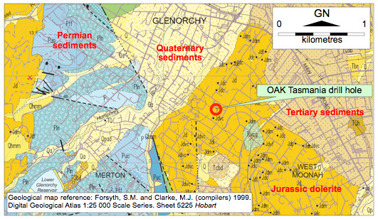
The published 1:25,000 scale digital geological map of the Hobart metropolitan area shows the OAK Tasmania’s Walkabout Industries site in Clydesdale Street, Glenorchy, and the neighbourhood, to be underlain by Jurassic-age dolerite.
New field evidence suggests the map needs to be amended.
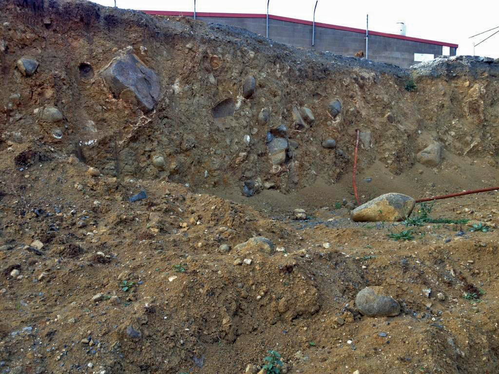
In 2011 bulk excavations at OAK provided excellent exposures of weakly-consolidated, orange-brown boulder beds (see photo). The clasts in the material are almost entirely angular to rounded dolerite cobbles and boulders up to about 0.5m in size, with a few percent of smaller clasts of chert, and Parmeener Supergroup siltstone and sandstone.
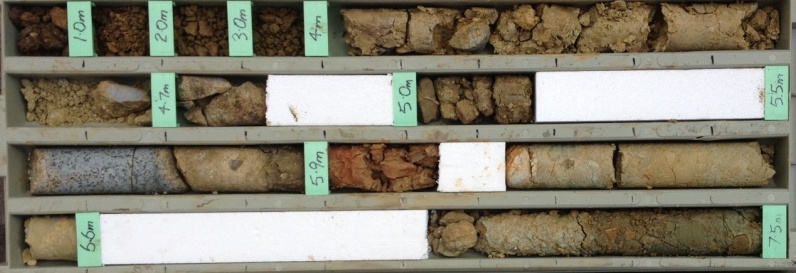
In July 2013, a 9.6m deep auger-and-diamond drill hole sited adjacent to the excavation encountered 5.6m of similar doleritic boulder beds, overlying conglomerate composed entirely of Parmeener Supergroup sandstone and siltstone clasts to 50mm in a non-plastic silt/sand/gravel matrix. A band of pink/orange silty clay occurred in the conglomerate over the 5.90-6.05m depth interval. See the photo of the core, and the log of the hole.
I interpret the deposits in the excavation and drill hole to be Tertiary in age and of similar fault-scarp related origin to other boulder beds in the Hobart district. I think the thin horizon of silty clay in the drill hole could be volcanic ash. It is not clear how far the Tertiary deposits extend laterally from the OAK Tasmania site.


Leave a Reply